Airport
Operational information for the private Nymburk ultralight airfield. Certified aircraft with prior consent of the operator or flight operations manager – no landing fees are charged.
Operational data
Airfield details
| Airfield name | Nymburk Airfield (LKNYMB, LKNYMB-U) |
|---|---|
| ARP coordinates | N 50°10′09″ E 015°03′08″ (WGS-84) |
| Location | 1.5 km SSE of Nymburk |
| Elevation | 186 m / 610 ft |
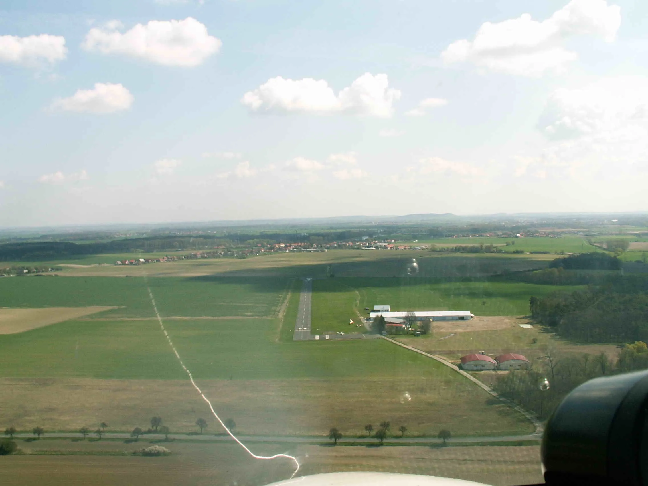
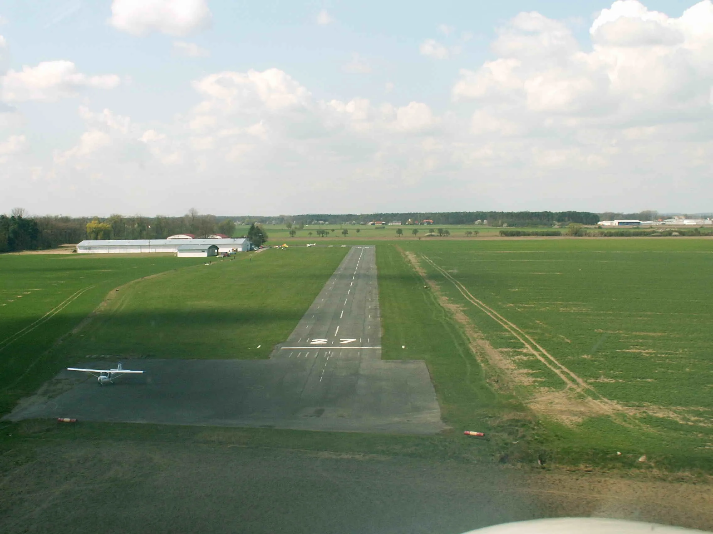
| Runway | asphalt 600 × 15 m (TORA 550 m, TODA 600 m, ASDA 600 m, LDA 550 m); smooth transition to grass strip; RWY 09–27 (087° – 267° MAG 2010) |
| Call sign, frequency | NYMBURK RADIO 123.465 MHz |
| Circuits | primarily SOUTH (RWY 09 – right, RWY 27 – left), 1,400 ft AMSL |
| Operating hours | irregular |
| Seasonal availability | year-round; snow clearing subject to operator’s needs and resources |
| Fuel, oils | unleaded Natural 95 without bio additives; oils TTS, R4 on request |
| Services | minor repairs, free Wi-Fi, hot and cold drinks, light refreshments, help arranging local accommodation, short-term hangarage by arrangement |
Runway finals
Runway view
Bike hire: the flat Elbe lowlands are ideal for cycling. Rent one of three serviced bikes with a lock for CZK 20.
Safety
Operating conditions & restrictions
- Do not overfly surrounding villages (Kovanice, Hořátev, Chvalovice) or the town of Nymburk unless necessary for safety. On the south circuit, shape the pattern to avoid Kovanice.
- Above the airfield at 2,000 ft AMSL lies the lower limit of MTMA Čáslav. To the north (1.5 km) is TRA62 (3,000 ft AMSL – FL245), with the circular TRA61 (GND – FL95) inside. About 5 km west is the eastern boundary of MTMA II Kbely (lower limit 2,500 ft AMSL).
- Extra caution on RWY 09 approach in S–SE wind (turbulence and wind shear from the forest and buildings).
- Beware of possible game movement on and near the runway. The area south of the runway is used by model flyers.
- The Nymburk–Hořátev road west of the field (RWY 09 approach, RWY 27 take-off) must be overflown at least 10 m AGL.
- Taxiing aircraft under their own power on the asphalt between hangars is prohibited – danger to persons!
Maps
Location, airspace and circuits
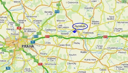
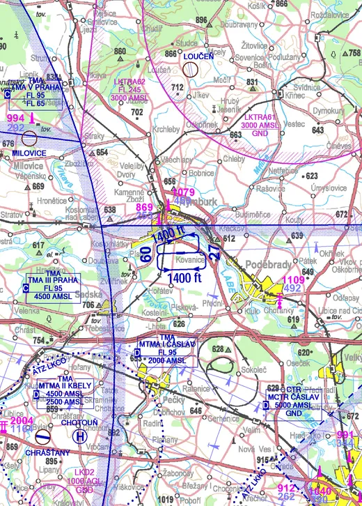
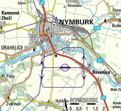
Sources: mapy.cz, ANS CR. Maps are indicative; always use current aeronautical information (see Contact & links).